| Contributors | Affiliation | Role |
|---|---|---|
| Gifford, Dian J. | University of Rhode Island (URI-GSO) | Co-Principal Investigator |
| Wishner, Karen | University of Rhode Island (URI-GSO) | Co-Principal Investigator |
| Allison, Dicky | Woods Hole Oceanographic Institution (WHOI BCO-DMO) | BCO-DMO Data Manager |
SCANFISH CTD Data Endeavor Cruises 321 and 325
PI Notes:
The Scanfish is a towed undulating vehicle carrying a CTD and several other sensors and was utilized on Endeavor Cruises 321 and 325 to Georges Bank. The scanfish is towed along various transacts to map the hydrographic properties of a survey area. During each cruise a number of tows were carried out, and the data are organized by tow. The SeaBird 911plus CTD records data at 24 Hz. It has been processed following the procedures outlined by O'Malley, et al (1998) and subsequently averaged to 1 Hz.
REFERENCE
O'Malley, R., J. A. Barth, A. Erofeev, J. Fleischbein, P. M. Kosro, and S. D. Pierce. SeaSoar CTD Observations During the Coastal Mixing and Optics Experiment: R/V Endeavor Cruises from 14-Aug to 1-Sep 1996 and 25-Apr to 15-May 1997. College of Oceanic & Atmospheric Sciences, Oregon State University, Corvallis. Reference 98-1, Data Report 168, October 1998.
Questions regarding these data should be directed to:
Dian J. Gifford
Graduate School of Oceanography
University of Rhode Island
Narragansett, RI 02882-1197
phone: 401-874-6690
fax: 401-874-6240
E-mail: gifford@gsosun1.gso.uri.edu
or
Karen Wishner
Graduate School of Oceanography
University of Rhode Island
Narragansett, RI 02882-1197
phone: 401-874-6402
E-mail: kwishner@gsosun1.gso.uri.edu
Last updated, March 24, 2006, gfh
The Scanfish is a towed undulating vehicle carrying a CTD and several other sensors and was utilized on Endeavor Cruises 321 and 325 to Georges Bank. The scanfish is towed along various transacts to map the hydrographic properties of a survey area. During each cruise a number of tows were carried out, and the data are organized by tow. The SeaBird 911plus CTD records data at 24 Hz. It has been processed following the procedures outlined by O'Malley, et al (1998) and subsequently averaged to 1 Hz.
| File |
|---|
scanfish.csv (Comma Separated Values (.csv), 24.87 MB) MD5:33d676c2675b66d50fda7d75925a2ba0 Primary data file for dataset ID 2432 |
| Parameter | Description | Units |
| cruiseid | cruise identification | |
| year | year, 4 digit | |
| tow | tow number within cruise | |
| yrday_gmt | year day based on Julian calendar (Jan. 1, noon = 1.5) | |
| lat | latitude, negative = South | DD.D |
| lon | longitude, negative = West | DDD.D |
| press | depth of sample reported as pressure | decibars |
| temp | water temperature, ITS90 | deg. C |
| sal | salinity, PSS-78, PSU | |
| sigma_t | sigma_t | kg/m<sup>3</sup> |
| o2 | dissolved oxygen | ml/l |
| chl_a | chlorophyll as derived from a CTD mounted fluorometer | <i>u</i>g/l |
| Dataset-specific Instrument Name | SeabirdCTD |
| Generic Instrument Name | CTD Sea-Bird |
| Dataset-specific Description | The SeaBird 911plus CTD records data at 24 Hz. |
| Generic Instrument Description | Conductivity, Temperature, Depth (CTD) sensor package from SeaBird Electronics, no specific unit identified. This instrument designation is used when specific make and model are not known. See also other SeaBird instruments listed under CTD. More information from Sea-Bird Electronics. |
| Dataset-specific Instrument Name | Scanfish |
| Generic Instrument Name | Scanfish |
| Dataset-specific Description | The Scanfish is a towed undulating vehicle carrying a CTD and several other sensors and was utilized on Endeavor Cruises 321 and 325 to Georges Bank. |
| Generic Instrument Description | The Scanfish is a remotely operated, towed, undulating vehicle system designed for collecting 3D profile data of the water column. It includes a Conductivity, Temperature, Depth (CTD) profiler as part of the instrument package. The Scanfish housing has fins to allow it to dive and rise, an altimeter to determine the depth of the unit, a pump that moves water through the system and a data cable that reports data back to the ship as the fish is being towed through the water behind the vessel. The Scanfish can be configured with additional sensors, e.g. fluorometer. |
| Website | |
| Platform | R/V Endeavor |
| Start Date | 1999-03-28 |
| End Date | 1999-04-11 |
| Description | process Methods & Sampling The Scanfish is a towed undulating vehicle carrying a CTD and several other sensors and was utilized on Endeavor Cruises 321 and 325 to Georges Bank. The scanfish is towed along various transacts to map the hydrographic properties of a survey area. During each cruise a number of tows were carried out, and the data are organized by tow. The SeaBird 911plus CTD records data at 24 Hz. It has been processed following the procedures outlined by O'Malley, et al (1998) and subsequently averaged to 1 Hz. |
| Website | |
| Platform | R/V Endeavor |
| Start Date | 1999-06-13 |
| End Date | 1999-06-30 |
| Description | process Methods & Sampling The Scanfish is a towed undulating vehicle carrying a CTD and several other sensors and was utilized on Endeavor Cruises 321 and 325 to Georges Bank. The scanfish is towed along various transacts to map the hydrographic properties of a survey area. During each cruise a number of tows were carried out, and the data are organized by tow. The SeaBird 911plus CTD records data at 24 Hz. It has been processed following the procedures outlined by O'Malley, et al (1998) and subsequently averaged to 1 Hz. |
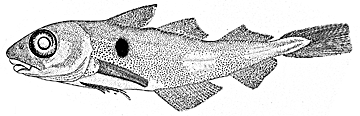
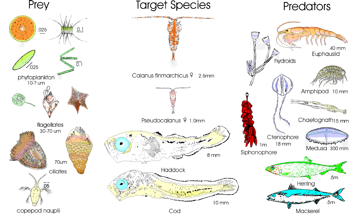
The U.S. GLOBEC Georges Bank Program is a large multi- disciplinary multi-year oceanographic effort. The proximate goal is to understand the population dynamics of key species on the Bank - Cod, Haddock, and two species of zooplankton (Calanus finmarchicus and Pseudocalanus) - in terms of their coupling to the physical environment and in terms of their predators and prey. The ultimate goal is to be able to predict changes in the distribution and abundance of these species as a result of changes in their physical and biotic environment as well as to anticipate how their populations might respond to climate change.
The effort is substantial, requiring broad-scale surveys of the entire Bank, and process studies which focus both on the links between the target species and their physical environment, and the determination of fundamental aspects of these species' life history (birth rates, growth rates, death rates, etc).
Equally important are the modelling efforts that are ongoing which seek to provide realistic predictions of the flow field and which utilize the life history information to produce an integrated view of the dynamics of the populations.
The U.S. GLOBEC Georges Bank Executive Committee (EXCO) provides program leadership and effective communication with the funding agencies.
U.S. GLOBEC (GLOBal ocean ECosystems dynamics) is a research program organized by oceanographers and fisheries scientists to address the question of how global climate change may affect the abundance and production of animals in the sea.
The U.S. GLOBEC Program currently had major research efforts underway in the Georges Bank / Northwest Atlantic Region, and the Northeast Pacific (with components in the California Current and in the Coastal Gulf of Alaska). U.S. GLOBEC was a major contributor to International GLOBEC efforts in the Southern Ocean and Western Antarctic Peninsula (WAP).
| Funding Source | Award |
|---|---|
| National Oceanic and Atmospheric Administration (NOAA) | |
| NSF Division of Ocean Sciences (NSF OCE) |